![[About.me]](https://thnguyen-grs.github.io/images/huy.png)
The polygonization algorithm is now available online
Published:
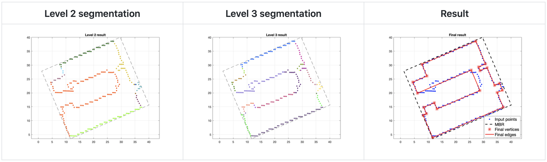
I have made publically the Github (link below) dedicated to the polygonization algorithm for building footprints. It is developed based on the work of Dutter [1].
This algorithm was used in our work presented at the ISPRS PIA+MRSS 2019 conference (Munich, Germany). It works well on relatively complex boundaries, yielding very accurate polygonal outlines, without requiring any supervision or manual editting from human operators. However, they are only designed for buildings of perpendicular and parallel wings, as well as having perpendicular corners.
The research work presents an unsupervised building extraction method, wrapped up by this polygonization step. It was awarded the Best Poster Award at the PIA 2019 conference. You may find the link to the paper below.
Paper: https://arxiv.org/abs/1907.06206
Github: https://github.com/nthuy190991/polygonization_PIA2019
[1] Dutter, M. (2007). Generalization of building footprints derived from high resolution remote sensing data, Institut für Photogrammetrie und Fernerkundung, Technische Universität Wien.